
THE ROAD IS THE DESTINATION.
White Trash Networks has covered biker culture since 1999. Roadhouse takes that spirit beyond the headlines: actual roads, landmark stops, biker hangouts and places to rest between long miles. Browse hand-picked locations across Ontario, North America and the United Kingdom.
Every listing includes a real photograph of its location or landmark, a map link and an information source. We start with places we can document; the directory will keep growing with responsible community submissions.
Roads & Routes
12 places to explore
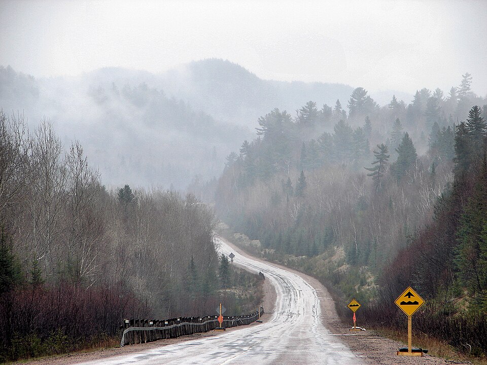
Ontario’s Highway 129 — The Northern Dragon
Thessalon to Chapleau, Ontario
For riders who want curves instead of traffic lights, Highway 129 is one of Northern Ontario’s standout roads. Running between Thessalon and Chapleau, the highway follows stretches of the Mississagi River through rock cuts, wooded valleys and remote country where the scenery changes around almost every bend. Its southern section is especially well known for successive corners and elevation changes, earning comparisons with the American Tail of the Dragon. Make the ride part of the larger Grand Algoma tour if you have a full weekend. Rider’s note: Fuel and services are farther apart than on southern Ontario highways, wildlife can appear without warning, and road conditions can change quickly with weather.
Photo: P199 · CC BY-SA · Photo author & licence

Algonquin Park — Highway 60
Huntsville to Whitney, Ontario
Highway 60 cuts through the heart of Algonquin Provincial Park, making it a beautiful alternative to a straight highway run. Between the Huntsville and Whitney approaches, riders pass forest, lakes, rock outcrops and established park access points. In autumn, colourful hardwoods turn the route into a scenic cruise; in summer, the same stretch is popular with hikers, campers and sightseers. Take time for designated pull-offs and the park’s visitor facilities rather than treating the whole trip as a speed run. Rider’s note: Expect wildlife, changing light beneath the trees and heavy holiday traffic. Check park access requirements and current road conditions before stopping at park facilities.
Photo: aiko99ann · CC BY-SA · Photo author & licence

Grand Algoma — Old Woman Bay
Lake Superior Provincial Park, Ontario
Old Woman Bay is one of those stops that explains why riders travel the Lake Superior coast in the first place. The bay sits within Lake Superior Provincial Park, backed by steep wooded cliffs and a sweeping shoreline that makes a fine break from long days on the saddle. It fits naturally into a Grand Algoma ride linking Highway 17’s coastal views with the tighter inland curves of Highway 129. Pack a camera and allow time to enjoy the beach and viewpoints rather than simply pulling in and turning around. Rider’s note: Lake Superior weather can feel much colder than inland temperatures, and parking or visitor access may be busier in summer.
Photo: Beckettlc · CC0 · Photo author & licence

Highway 17 — Agawa Bay Coast
Near Wawa and Sault Ste. Marie, Ontario
This part of the Trans-Canada Highway is less about getting from town to town and more about riding beside an inland sea. Near Agawa Bay, Highway 17 winds through Lake Superior Provincial Park, revealing rocky headlands, forest and broad views of the water. The bay itself has a long sandy beach, a campground and access to park information, making it a useful pause or an overnight stop on a northern tour. A camera, an extra layer and a flexible schedule are worth having here. Rider’s note: Shoreline fog, rain, wildlife and changing temperatures are possible even on a pleasant summer day. Plan fuel stops ahead.
Photo: Beckettlc · Wikimedia Commons · Photo author & licence

Calabogie & Ride the Highlands
Calabogie, Eastern Ontario
Calabogie sits in a part of the Ottawa Valley where the fun is in the road itself. The official Ride the Highlands “Calabogie Boogie” loop runs about 215 km and takes in roads such as Calabogie, Centennial Lake and Opeongo, mixing tighter corners with rolling scenery and small-town stops. It is the sort of route that works as a dedicated day ride or as one leg of a longer eastern Ontario weekend. Along the way, watch for cafés, village stops and viewpoints that let you turn the ride into a proper outing. Rider’s note: The route organizer warns that surfaces can vary between asphalt and tar-and-chip, with occasional roadworks and seasonal changes.
Photo: Wikimedia Commons · Photo author & licence

Thousand Islands Parkway
Gananoque to Brockville area, Ontario
For a more relaxed ride, the Thousand Islands Parkway traces the St. Lawrence River through one of eastern Ontario’s most distinctive landscapes. Islands, waterfront views and access to communities near Gananoque and Brockville make this an easy place to combine cruising with a lunch stop or an afternoon of exploring. It is particularly appealing when you want scenic miles rather than a technical mountain road. Keep an eye out for designated places to stop and enjoy the river rather than pulling off unpredictably. Rider’s note: Summer tourism increases traffic, and some waterfront areas may have parking restrictions. Allow time to leave the parkway and visit local communities.
Photo: Wikimedia Commons · Photo author & licence

French River & Georgian Bay Country
French River, Ontario
The French River area marks a classic transition into Northern Ontario: granite outcrops, dark-green pine, broad waterways and long stretches of Canadian Shield scenery. It is a worthwhile destination for riders exploring the Highway 69/400 corridor or planning a longer loop around Georgian Bay. The French River Visitor Centre and surrounding park landscape offer a reason to get off the motorcycle, learn about the region and enjoy the views. This is a scenic stop rather than a tight, purpose-built motorcycle route. Rider’s note: Travel distances can grow quickly once you leave major communities, and weather on exposed rock and waterfront areas may differ from inland conditions.
Photo: Wikimedia Commons · Photo author & licence
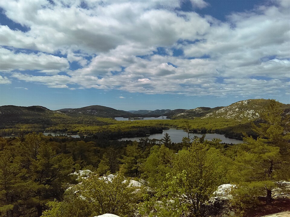
Killarney Road — Highway 637
Killarney and La Cloche region, Ontario
The ride into Killarney along Highway 637 feels like a journey away from the main highways and toward the edge of Georgian Bay. Forest, rocky terrain and water appear along the way, while the La Cloche landscape gives the region its distinctive character. The village is a natural turnaround point for a day ride, and Killarney Provincial Park offers further opportunities for hiking, paddling and sightseeing if you are spending longer in the area. The listing photograph shows the park landscape rather than the road itself. Rider’s note: This is a side trip with limited services compared with a major highway. Check your fuel level, road surface and seasonal park access before heading in.
Photo: Natalia Wegrzyn · Wikimedia Commons · Photo author & licence
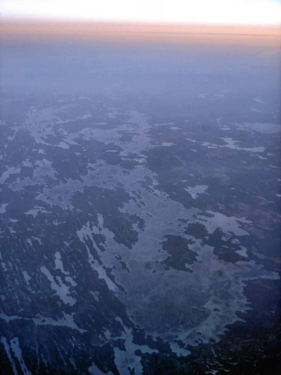
Muskoka Lake Country
Bracebridge, Bala and Muskoka Lakes, Ontario
Muskoka is tailor-made for riders who prefer backroads, small communities and changing lake scenery over long freeway stretches. The area around Bracebridge, Bala and the Muskoka Lakes offers a web of roads with gentle elevation changes, forest views and plenty of opportunities to stop for food or a waterfront walk. Highway 118 is a common starting point, but the appeal is connecting a few nearby roads into a ride that suits your own pace. Early mornings and shoulder-season days can feel especially peaceful. Rider’s note: Summer cottage traffic, cyclists, gravel at driveway entrances and popular town centres can slow progress. Be prepared for frequent turns and local traffic.
Photo: Wikimedia Commons · Photo author & licence
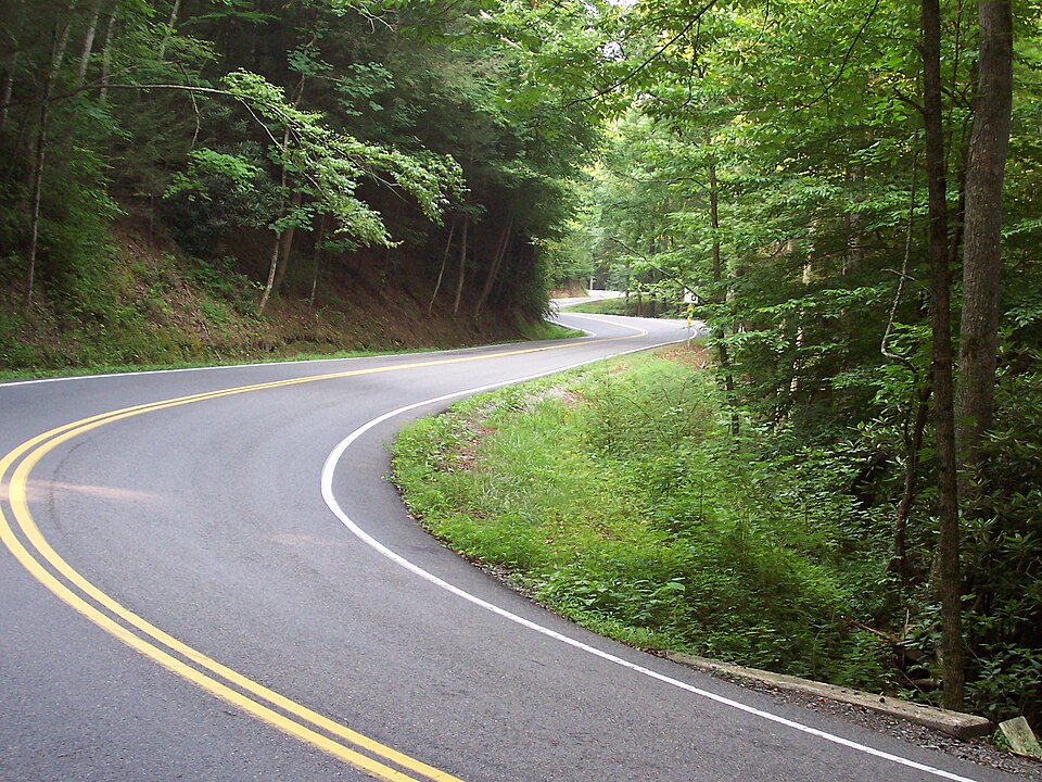
Tail of the Dragon — US 129
Deals Gap, Tennessee / North Carolina, USA
This is one of the best-known motorcycle roads in America for a reason. The Tail of the Dragon packs a reported 318 curves into 11 miles of US 129 at Deals Gap on the Tennessee–North Carolina border. There are no ordinary town intersections along the famous stretch, just repeated turns that demand full concentration. Riders often make a day of it by meeting at nearby stops, watching the mix of machines and exploring other Smoky Mountain roads. Rider’s note: Do not treat the road as a racetrack. Stay in your lane, allow room for oncoming vehicles, watch for changing weather and use the official route guide before riding.
Photo: Wikimedia Commons · CC BY-SA · Photo author & licence

Blue Ridge Parkway
Virginia and North Carolina, USA
The Blue Ridge Parkway is a journey meant to be enjoyed slowly. Stretching through the mountains of Virginia and North Carolina, it offers long ridgeline views, forested curves and scenic overlooks that make it ideal for a multi-day motorcycle trip. Unlike the Tail of the Dragon, the reward here is steady, unhurried touring: pull into an overlook, take in the mountain layers, then continue to the next valley or ridge. Nearby towns and connecting roads make it easy to build a custom itinerary. Rider’s note: Fog, wind, rain and temporary closures can affect the route, especially at higher elevations. Check National Park Service road advisories before leaving.
Photo: Maria Kozmina · CC BY-SA · Photo author & licence
Beartooth Highway
Montana and Wyoming, USA
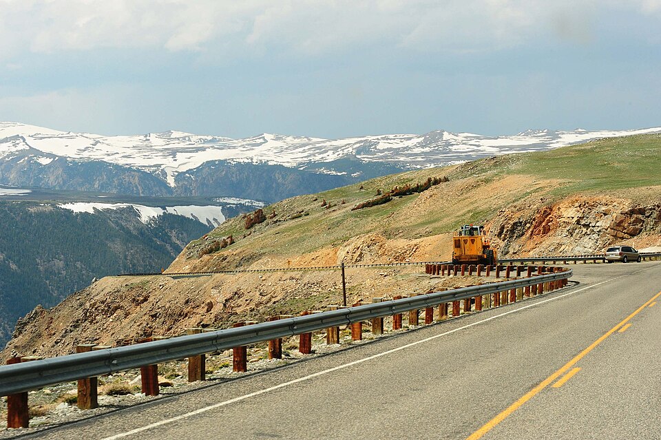
Beartooth Highway is the sort of mountain ride that stays in a rider’s memory long after the trip. The road climbs into spectacular high-elevation country along the Montana–Wyoming border, with broad alpine views, hairpin turns and dramatic changes in the landscape. Even in summer, snow can remain near the road and temperatures may drop sharply compared with nearby valleys. Allow plenty of time for safe stops, photographs and unexpected weather rather than trying to rush the mountain crossing. Rider’s note: The highway is seasonal and can close temporarily because of snow or storms. Check official road-opening and closure information, carry warm layers and keep an eye on fuel.
Photo: US National Archives · Public domain · Photo author & licence
Biker Hangouts & Ride Stops
13 places to explore

Port Dover — Friday the 13th Country
Port Dover, Ontario
Port Dover is a small Lake Erie community with an enormous place in Ontario motorcycle culture. For more than four decades, riders have gathered here whenever the calendar hits Friday the 13th, filling the downtown area with motorcycles, street vendors and conversation. Even outside the rally days, the harbour, lighthouse, beach and local businesses make it a worthwhile destination for a relaxed ride. It is a place to soak up the social side of motorcycling rather than tackle difficult corners. Rider’s note: On event days, parking, access routes and traffic patterns change significantly. Check Norfolk County’s official event map and parking guidance before arriving.
Photo: Wikimedia Commons · Photo author & licence
Bridal Veil Falls — Manitoulin
Kagawong, Manitoulin Island, Ontario
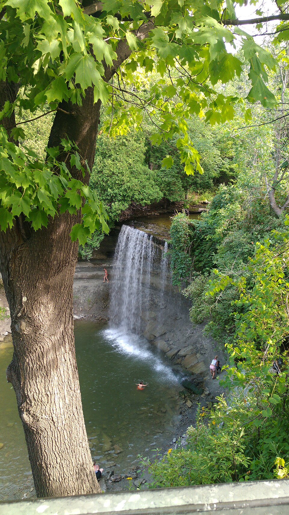
Bridal Veil Falls is a memorable stop near Kagawong on Manitoulin Island, especially for riders who want a short break with something worth seeing. The waterfall and surrounding woodland offer a change from the island’s open roads, lake views and small communities. It is a good place to stretch your legs, take photographs and slow the pace of an otherwise long touring day. You can work it into a larger Manitoulin loop or a trip that also involves the ferry to Tobermory. Rider’s note: The attraction requires leaving the motorcycle and walking to the viewing area. Check access conditions and respect pathways, private land and posted safety notices.
Photo: Jeandre1794 · CC BY-SA 4.0 · Photo author & licence

Tobermory Harbour
Tobermory, Bruce Peninsula, Ontario
At the tip of the Bruce Peninsula, Tobermory feels like a proper endpoint to a long ride. Its harbour is known for clear water, busy docks and a walkable waterfront where riders can grab a meal or take a break before continuing. The town is also the southern terminal for the Chi-Cheemaun ferry to Manitoulin Island, making it useful for building a loop instead of retracing the same highway. Nearby parks and shoreline scenery can turn a brief visit into a full weekend. Rider’s note: Summer traffic and parking can be busy, and ferry departure times require planning. Confirm local access, bookings and the sailing schedule before arrival.
Photo: WabbitWanderer · Wikimedia Commons · Photo author & licence

MS Chi-Cheemaun Ferry
Tobermory to South Baymouth, Ontario
The Chi-Cheemaun is more than transport: it lets riders connect the Bruce Peninsula and Manitoulin Island across Georgian Bay without backtracking by road. The vessel sails between Tobermory and South Baymouth when in seasonal service, and the crossing itself becomes part of the tour, with views from the deck and onboard spaces to relax. The operator lists a typical crossing of approximately 1 hour 45 minutes in peak season, and longer off-peak crossings. Rider’s note: This is not a year-round service; the 2026 season has ended and the operator says 2027 reservations will open in March 2027. Check motorcycle booking requirements and arrive according to the ferry company’s instructions.
Photo: WabbitWanderer · Wikimedia Commons · Photo author & licence

Kakabeka Falls
Near Thunder Bay, Ontario
Kakabeka Falls is an excellent break for riders crossing Northwestern Ontario near Thunder Bay. The waterfall drops over a dramatic rock face, and the park offers established viewing areas that let visitors enjoy the scene without a long expedition. It works well as a short roadside detour on a Lake Superior tour or as an outing from Thunder Bay. The sound and scale of the falls make it more memorable than an ordinary fuel stop. Rider’s note: Expect to park and walk to viewing areas, and follow marked paths and barriers around steep drops. Ontario Parks lists year-round day-use access, but specific services and trails can vary seasonally.
Photo: Michael Cannon · CC BY-SA 4.0 · Photo author & licence

Ouimet Canyon Lookouts
Dorion area, Ontario
Ouimet Canyon rewards riders who are willing to leave the highway for a short scenic detour. The gorge is roughly 150 metres wide, with cliffs dropping around 100 metres to the floor. A boardwalk and trail connect two lookouts, offering an elevated view over the dramatic rock walls and the unusual plant habitat below. The park is reached from Highway 11/17 by Ouimet Canyon Road and is a striking stop for anyone touring north of Lake Superior. Rider’s note: This is a day-use park with seasonal opening dates. Wear suitable footwear for the lookout walk and stay behind barriers.
Photo: Wikimedia Commons · Photo author & licence

Sleeping Giant Country
Thunder Bay area, Ontario
Sleeping Giant Provincial Park occupies the Sibley Peninsula near Thunder Bay, where the Lake Superior coastline meets forested terrain and striking rock formations. The park is known for the silhouette that gives it its name, scenic lookouts and a network of hiking trails; Ontario Parks also highlights the Thunder Bay Lookout and the visitor centre’s local-history displays. For motorcycle travellers, the experience is best treated as a destination with time for walking rather than a simple drive-through viewpoint. Rider’s note: Reaching some highlights requires a separate walk or hike, not just motorcycle access. Check the status of Highway 587, park facilities and trail conditions before visiting.
Photo: Wikimedia Commons · Photo author & licence

Sauble Beach
South Bruce Peninsula, Ontario
Sauble Beach is one of the Bruce Peninsula region’s classic summer stops, with a long Lake Huron shoreline and a relaxed beach-town atmosphere. It fits well into a ride through Southampton, Wiarton or the surrounding country roads, especially if you want a casual place to get off the motorcycle, have a meal and enjoy the lake. Expect a lively atmosphere during warm-weather weekends and a much quieter experience outside the main holiday season. Rider’s note: Parking rules, beach access and local traffic patterns can change seasonally. Check municipal information before arrival and be courteous to residents and other visitors.
Photo: Wikimedia Commons · Photo author & licence

Ace Cafe London
Stonebridge, London, United Kingdom
For anyone interested in where modern motorcycle café culture came from, Ace Cafe London is a genuine historic stop. Established in 1938 beside the North Circular Road, the cafe became famous as a meeting place for Britain’s Ton-Up boys, Rockers and riders drawn to motorcycles and rock ’n’ roll. Today its heritage lives on through a busy calendar of enthusiast gatherings, food and music. It is as much about the people and stories around the machines as it is about the ride to get there. Rider’s note: Event schedules and opening arrangements can change, so check the official calendar before planning a visit, particularly for a group.
Photo: Matthew Smith · CC BY-SA 2.0 · Photo author & licence
Daytona Bike Week — Main Street
Daytona Beach, Florida, USA
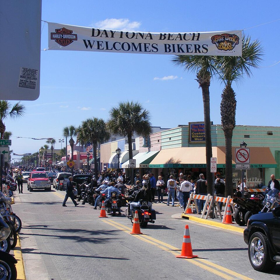
During Daytona Bike Week, the Main Street area becomes one of the most recognizable scenes in American motorcycle culture. Rows of parked bikes, live entertainment, restaurants and vendor activity create a place where riders can spend hours walking, talking and exploring different custom machines. Many visitors build their trip around the broader Daytona Beach area, including scenic coastal rides and official rally activities. The photograph on this listing is an archival Bike Week image from 2008, not a view of current crowds. Rider’s note: Expect very heavy traffic and changes to parking or access during major events. Use the event organizer’s current information when planning.
Photo: Gamweb · CC BY-SA (historic 2008 photo) · Photo author & licence

Sturgis Main Street
Sturgis, South Dakota, USA
A trip to Sturgis is about more than one street, but Main Street is where many riders head to experience the atmosphere of the annual rally. During rally week, downtown fills with bikes, visitors, rally vendors and people meeting up before or after riding the Black Hills. Outside the busiest dates, Sturgis is still a useful starting point for exploring the surrounding region by motorcycle. The listing photo shows a previous rally rather than live conditions. Rider’s note: Rally-week parking, crowd levels and street restrictions can be very different from normal days. Plan extra time and use official local information for current arrangements.
Photo: Cumulus Clouds · Wikimedia Commons · Photo author & licence

The Knuckle Saloon
931 1st Street, Sturgis, South Dakota, USA
The Knuckle Saloon is a historic Sturgis biker gathering place at 931 1st Street, with a long bar, motorcycle memorabilia and a reputation for live music and rally-week entertainment. The property also has food and outdoor gathering areas, making it the sort of stop where visitors can experience the social side of the Sturgis scene. Its identity is tied to Black Hills motorcycle culture rather than simply being another bar beside the highway. Important planning note: The venue’s own website currently says “Reopening Spring 2027.” Do not assume it is open now; confirm its reopening date, hours and event calendar directly before travelling.
Photo: Tony Webster · CC BY 2.0 · Photo author & licence

The Rock Store
Cornell, Santa Monica Mountains, California, USA
The Rock Store has long been a favourite meeting point for Southern California motorcyclists exploring the Santa Monica Mountains. Located in the Cornell area near canyon riding roads, it is associated with weekend bike gatherings and the tradition of stopping to admire interesting machines after a ride. For a visitor, the appeal is as much the road and rider community as the establishment itself. Consider connecting the stop with a carefully planned ride through the surrounding mountain roads, allowing for road closures or detours after storms. Rider’s note: Hours, access and local road conditions can change, so verify them on the official business site before heading out.
Photo: Steve Lyon · CC BY-SA 2.0 · Photo author & licence
Camping & Motorcycle Stays
2 places to explore

Bon Echo Provincial Park Camping
Cloyne, Ontario
Bon Echo Provincial Park is a strong base for a motorcycle weekend in eastern Ontario. The park is known for Mazinaw Lake and dramatic rock scenery, while nearby roads lead through quiet communities, forest and lake country. Official park facilities include several car-camping areas, comfort stations with showers and flush toilets, beaches and visitor services, making it a practical place to finish a day on the bike. Riders who prefer a longer stay can combine sightseeing with a few different day routes. Rider’s note: Reserve your site in advance during busy periods, check park operating dates and confirm whether your campsite has electricity or other amenities before booking.
Photo: Margivy · CC BY-SA · Photo author & licence

Agawa Bay Campground
Lake Superior Provincial Park, Ontario
Agawa Bay is the kind of place where you can park the motorcycle and end the day looking out over Lake Superior. The campground sits beside a roughly 3-kilometre beach in Lake Superior Provincial Park, adjacent to Highway 17 and surrounded by mature pine. Ontario Parks lists 147 campsites, including 38 electrical sites, plus comfort stations with showers, washrooms and laundry. A visitor centre is a short walk away, making it a convenient overnight stop on the north-shore touring route. Rider’s note: The lakeshore can be cold and windy, even in summer. Reservations, operating dates and amenity availability are seasonal, so verify details before riding in.
Photo: Wikimedia Commons · Photo author & licence
More Ontario Roads & Ride Stops
20 destinations

Highway 71 — Sioux Narrows Ride
Fort Frances–Kenora, Ontario
An inviting mix of wooded bends, lake country and small communities along the northwestern Ontario route to Kenora. Sioux Narrows is the perfect place for a relaxed lakeside break; ride this road for the scenery rather than the shortest travel time. Rider’s note: Fuel up in larger towns, watch for wildlife, and leave daylight for unplanned stops.
Photo: Wikimedia Commons · Photo author & licence

Highway 599 — Road to Pickle Lake
Ignace–Pickle Lake, Ontario
A northern adventure highway through seemingly endless boreal forest and remote lakes. Pickle Lake is far from the usual rally circuit, and that isolation is the point: quiet scenery and the feeling of a genuine wilderness journey. Rider’s note: Services are limited and cellphone coverage may be unreliable; plan fuel and emergency supplies.
Photo: Wikimedia Commons · Photo author & licence

Highway 64 — Marten River Country
Sturgeon Falls–Marten River, Ontario
Ride a changing landscape of small lakes, Canadian Shield outcrops and wooded bends north of Sturgeon Falls. This is a pleasant northeastern Ontario alternative for riders who want rural scenery and a few communities worth exploring. Rider’s note: Stay alert for wildlife, surface changes and wet pavement near shaded corners.
Photo: Wikimedia Commons · Photo author & licence

Highway 105 — Red Lake Run
Vermilion Bay–Red Lake, Ontario
An adventurous trip north through Perrault Falls and Ear Falls toward Red Lake’s historic mining region. Forest, waterfalls and large lakes offer real rewards, while the distance between communities provides a taste of northern independence. Rider’s note: Fuel stops are separated by long distances and mobile coverage is intermittent.
Photo: Wikimedia Commons · Photo author & licence

Highway 527 — Armstrong Highway
Thunder Bay–Armstrong, Ontario
Highway 527 leads into remote country north of Thunder Bay, with long stretches of forest and few urban distractions. For prepared touring riders, its attraction is the feeling of exploration rather than roadside entertainment. Rider’s note: Use Ontario 511, plan fuel conservatively and check conditions before departure.
Photo: Wikimedia Commons · Photo author & licence

Highway 502 — Sunset Country Connector
Dryden district, Ontario
A rural connection through northwestern Ontario’s lakes and forest, Highway 502 can form part of a larger loop between Dryden and the Rainy River region. The scenery is quietly northern, with long stretches away from busy highways. Rider’s note: Check road conditions and distances before committing to a long detour.
Photo: Wikimedia Commons · Photo author & licence

Highway 560 — Shining Tree Country
Englehart–Highway 144, Ontario
Travelling past Elk Lake, Gowganda and Shining Tree, Highway 560 offers a long backcountry passage across northeastern Ontario. Expect thick forest, mining-country history and a pace far removed from crowded tourist corridors. Rider’s note: Check fuel, road status and daylight hours; services are sparse.
Photo: Wikimedia Commons · Photo author & licence
Highway 622 — Atikokan Country
Ignace–Atikokan, Ontario
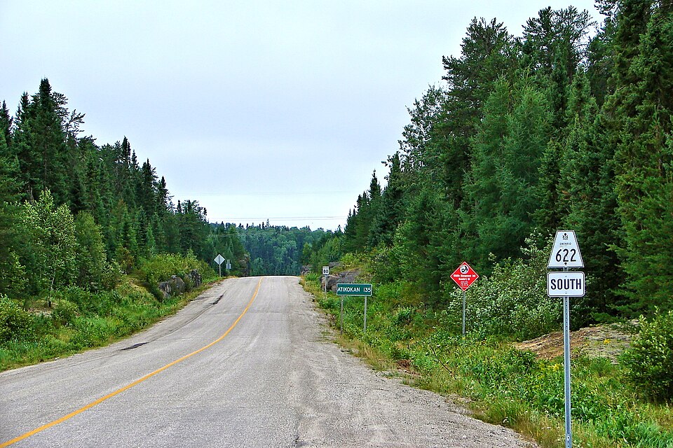
This quiet highway provides a route into Atikokan and nearby Quetico country from the Trans-Canada corridor. Northern forest and lake scenery make it a worthwhile addition to a longer trip across Sunset Country. Rider’s note: Confirm weather, road status and fuel availability before travelling.
Photo: Wikimedia Commons · Photo author & licence

Highway 72 — Sioux Lookout Run
Dinorwic–Sioux Lookout, Ontario
A northwestern Ontario route linking the Trans-Canada with the Sioux Lookout district. The landscape is dominated by boreal forest, water and small communities, making it a useful leg of an extended northern tour. Rider’s note: Allow extra time for wildlife and keep fuel and communications in mind.
Photo: Wikimedia Commons · Photo author & licence

Long Sault Parkway — Island Causeways
Long Sault, Ontario
A chain of islands connected by scenic causeways in the St. Lawrence River. The parkway’s broad water views and recreational areas invite riders to slow down, take photographs and learn about the changes caused by the St. Lawrence Seaway. Rider’s note: Check seasonal access rules, park fees and permitted stopping areas.
Photo: Wikimedia Commons · Photo author & licence

Niagara Parkway — River Road Cruise
Fort Erie–Niagara-on-the-Lake, Ontario
The Niagara Parkway runs beside the Niagara River, connecting gardens, viewpoints and communities near the famous Falls. It is a leisurely motorcycle day out with plenty to see off the bike. Rider’s note: Allow for busy tourist traffic, follow parking rules and take time to explore.
Photo: Wikimedia Commons · Photo author & licence

Wawa Goose — Classic Roadside Stop
Wawa, Ontario
One of Canada’s most famous roadside statues marks a familiar landmark for riders crossing the Lake Superior corridor. The towering goose provides a memorable photograph and a chance to pause in Wawa before the next long highway leg. Rider’s note: Top off fuel and supplies before continuing along the north shore.
Photo: Wikimedia Commons · Photo author & licence
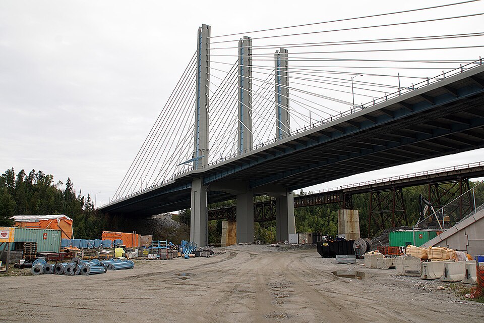
Nipigon River Bridge & Lookout Country
Nipigon, Ontario
This modern cable-stayed crossing is a distinctive landmark on the Trans-Canada route near the northern end of Lake Superior. The bridge and surrounding river scenery are a memorable part of a cross-country or lake-circle motorcycle journey. Rider’s note: Take photographs from designated viewpoints, never an active road shoulder.
Photo: Wikimedia Commons · Photo author & licence

Sioux Narrows Bridge
Sioux Narrows, Ontario
The bridge crosses a narrow passage among the islands and waters of Lake of the Woods. Together with the surrounding community it makes an excellent stopping point while riding Highway 71. Rider’s note: Expect tourism traffic during summer and use approved parking near the waterfront.
Photo: Wikimedia Commons · Photo author & licence

Lake of the Woods — Lakeshore Touring
Kenora region, Ontario
A vast lake dotted with islands, this destination shapes the character of northwestern Ontario. It rewards riders who choose specific lakeside viewpoints and communities rather than simply staying on the main highway. Rider’s note: Plan your stopping points: not every part of the shoreline is accessible by road.
Photo: Wikimedia Commons · Photo author & licence

Kenora & Lakefront Town Stops
Kenora, Ontario
Kenora combines Lake of the Woods scenery with restaurants, a harbour and a walkable downtown. It is a welcome chance to get off the bike during a long northwestern Ontario tour, or a base for exploring nearby Lake of the Woods roads. Rider’s note: Expect busy waterfront parking and seasonal crowds in summer.
Photo: Wikimedia Commons · Photo author & licence
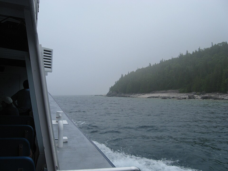
Flowerpot Island — Tobermory Side Trip
Fathom Five National Marine Park, Ontario
The tall shoreline rock columns at Flowerpot Island are among Georgian Bay’s most distinctive sights. This makes a rewarding excursion from Tobermory for riders who want to mix a long road trip with a boat ride and a walk. Rider’s note: Motorcycles stay in Tobermory; check boat schedules, park access and weather.
Photo: Wikimedia Commons · Photo author & licence

Point Pelee — Lake Erie Tip
Leamington, Ontario
This national park reaches into Lake Erie, offering beaches, wetlands and a chance to walk toward mainland Canada’s southern tip. It adds a peaceful nature stop to a southwestern Ontario motorcycle tour. Rider’s note: Check seasonal shuttle and visitor access, and allow time off the bike.
Photo: Wikimedia Commons · Photo author & licence

Presqu’ile Provincial Park
Brighton, Ontario
An appealing Lake Ontario stop with beaches, marshes, birdlife and historic coastal features. It fits nicely into a slower Highway 2 ride near Brighton, offering a break from the saddle and some time by the water. Rider’s note: Follow park entry rules and respect protected habitat.
Photo: Wikimedia Commons · Photo author & licence

Lake of Bays — Cottage Country
Muskoka, Ontario
Lake of Bays has the calm lakeshore views, pine forests and cottage-country villages riders associate with Muskoka. Combine it with Highway 35 and nearby backroads for a laid-back touring day. Rider’s note: Slow down through residential areas and allow for weekend traffic.
Photo: Wikimedia Commons · Photo author & licence
Across Canada — Coast to Coast Riding
20 destinations

Duffey Lake Road — Highway 99
Pemberton to Lillooet, British Columbia
Highway 99 climbs past mountain lakes and rugged peaks on the Duffey Lake portion of its route. For touring riders, the reward is a dramatic transition from valley forests to high country, with sweeping curves and viewpoints that make this a standout western Canadian ride. Rider’s note: The road is mountain travel: check snow, construction and provincial road reports before departure.
Photo: Wikimedia Commons · Photo author & licence

Okanagan Lake — Kelowna Cruise
Kelowna and West Kelowna, British Columbia
A leisurely lake-country ride through orchards, vineyards and communities around Okanagan Lake. Kelowna makes a convenient base for combining waterfront views with nearby inland roads, while the surrounding landscape gives a very different mood from British Columbia’s coastal mountains. Rider’s note: Plan around summer tourism and use public waterfront access rather than private lakeside drives.
Photo: Wikimedia Commons · Photo author & licence

Okanagan Lake Provincial Park
Near Summerland, British Columbia
A lakeside provincial park along Highway 97, useful as a stop between Penticton and Kelowna. The surrounding Okanagan landscape offers dry hills, open water and pleasant shoulder-season scenery. The photograph is an actual winter view of the park, not a picture of a particular campsite. Rider’s note: Confirm current campground operations and booking rules before planning an overnight stop.
Photo: Wikimedia Commons · Photo author & licence

Icefields Parkway — Rockies
Lake Louise to Jasper, Alberta
The 232-kilometre Icefields Parkway follows a remarkable corridor through the Canadian Rockies. Alpine peaks, glaciers, blue lakes and waterfalls reward riders who allow time for sightseeing. This is one of Canada’s genuinely iconic long-distance scenic roads. Rider’s note: Parks Canada warns that services and cell coverage are limited. Mountain weather can change rapidly, and a park pass may be needed.
Photo: Wikimedia Commons · Photo author & licence
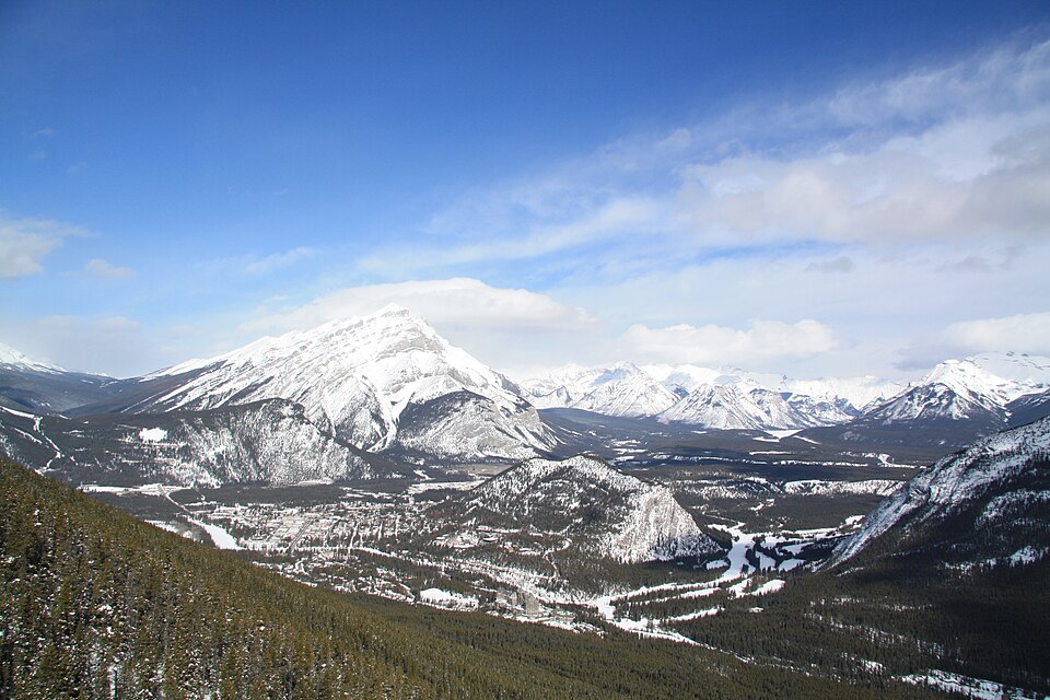
Banff National Park Scenic Stop
Banff, Alberta
Banff’s mountain scenery, rivers and historic visitor town make it a natural stop on a Rockies motorcycle trip. Riders can build a longer visit around nearby viewpoints, walking routes and scenic connecting roads rather than simply passing through on the Trans-Canada. Rider’s note: National park entry requirements, parking and seasonal traffic should be checked before arrival.
Photo: Wikimedia Commons · Photo author & licence

Two Jack Lake — Bow Valley Stop
Near Banff, Alberta
Two Jack Lake offers a scenic waterside break close to the Banff townsite, framed by forest and mountains. It is particularly appealing for a photo stop on a relaxed park ride or as a quiet contrast to the busiest downtown attractions. Rider’s note: Parking and access are regulated within the national park. Respect pedestrians and local wildlife.
Photo: Wikimedia Commons · Photo author & licence

Athabasca Falls — Jasper
Jasper National Park, Alberta
Athabasca Falls is a dramatic stop near the Icefields Parkway, where the river tumbles through a steep canyon. Short visitor trails and viewpoints give riders a chance to stretch their legs and enjoy one of Jasper’s best-known natural landmarks. Rider’s note: Stay on marked paths behind barriers. Follow Parks Canada updates for post-wildfire access changes.
Photo: Wikimedia Commons · Photo author & licence
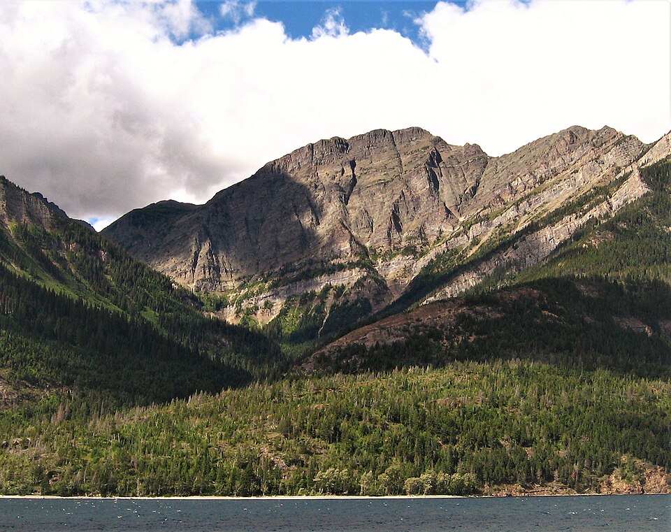
Waterton Lakes — Mountain Country
Waterton Lakes National Park, Alberta
Waterton sits where prairie meets the Rocky Mountains, creating a distinctive landscape of exposed peaks and long lakes. A touring day here rewards riders who slow down, explore the village area and appreciate the changing view as the mountains rise from open country. Rider’s note: Wind and rapidly changing mountain conditions are common; confirm park access and seasonal road openings.
Photo: Wikimedia Commons · Photo author & licence

Dinosaur Provincial Park
Brooks region, Alberta
A spectacular badlands landscape of eroded rock formations and dinosaur-fossil history, Dinosaur Provincial Park provides an unforgettable contrast to Alberta’s high mountain roads. Riders visiting the region can trade alpine scenery for desert-like coulees and interpretive activities. Rider’s note: Some areas require guided access; check park entry, road conditions and tour availability.
Photo: Wikimedia Commons · Photo author & licence

Dinosaur Provincial Park Camping
Brooks region, Alberta
Camping in the badlands can make a unique overnight chapter on an Alberta motorcycle tour. The park’s rocky formations and wide-open skies offer a very different experience from forested campgrounds. The photograph depicts an actual campsite area in the park. Rider’s note: Confirm campground reservations, amenities and hot-weather preparation before travelling.
Photo: Wikimedia Commons · Photo author & licence

Cabot Trail — Cape Breton Loop
Cape Breton Island, Nova Scotia
The Cabot Trail circles northern Cape Breton through coastal cliffs, highland viewpoints and fishing communities. Parks Canada describes a route of nearly 300 kilometres, with part passing through Cape Breton Highlands National Park. A motorcycle trip here is best enjoyed over at least a couple of days. Rider’s note: Watch for moose and sudden fog, and check seasonal park services and road conditions.
Photo: Wikimedia Commons · Photo author & licence

Aspy Bay — Cabot Trail Lookouts
Northern Cape Breton, Nova Scotia
Aspy Bay sits among dramatic headlands near the northern section of the Cabot Trail. Its rugged coastal views offer an appealing break from the road, with sea cliffs and broad Atlantic scenery that explain the area’s popularity with touring riders. Rider’s note: Allow time for coastal wind and weather changes, and stop only at marked viewpoints.
Photo: Wikimedia Commons · Photo author & licence
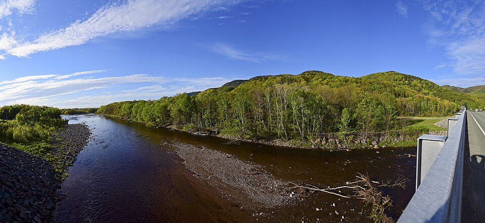
Chéticamp River Cabot Entrance
Chéticamp, Cape Breton, Nova Scotia
Chéticamp is a gateway to the western side of Cape Breton Highlands National Park. The river and mountain setting offer a natural pause before the Cabot Trail climbs into higher ground, and the community is known for its Acadian culture and services. Rider’s note: Fuel up before the national park section and check seasonal visitor-centre operations.
Photo: Wikimedia Commons · Photo author & licence

Peggy's Cove Coastal Stop
Peggy's Cove, Nova Scotia
Peggy’s Cove is a classic Atlantic Canadian destination, known for its lighthouse, fishing harbour and granite coastline. It is a worthwhile day trip from Halifax for riders who enjoy ocean roads, coastal villages and a stop to take in the scenery. Rider’s note: Never venture onto wave-washed rocks. Obey shoreline warning signs and expect busy visitor traffic.
Photo: Wikimedia Commons · Photo author & licence

Viking Trail — Gros Morne
Western Newfoundland
The Viking Trail on Newfoundland’s west coast takes riders through dramatic scenery around Gros Morne, with mountains, fjords and fishing communities along the journey north. It is a multi-day destination where the landscape often seems larger than the road itself. Rider’s note: Plan ferry travel, long distances and changeable coastal weather. Check Parks Canada access notices.
Photo: Wikimedia Commons · Photo author & licence
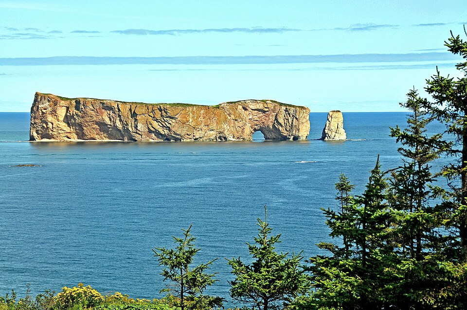
Percé Rock — Gaspé Coast
Percé, Québec
Percé Rock rises from the Gulf of St. Lawrence near the town of Percé, an extraordinary landmark on the coastal drive around the Gaspé Peninsula. Add the viewpoint and local harbour area to a longer Route 132 motorcycle trip for scenery that differs from inland Québec. Rider’s note: Coastal fog and winds can arrive quickly; stay on official trails and viewpoints.
Photo: Wikimedia Commons · Photo author & licence

Hopewell Rocks — Fundy Coast
Hopewell Cape, New Brunswick
The Hopewell Rocks are sculpted sea stacks shaped by the Bay of Fundy’s famous tides. During low tide, visitors can walk onto the ocean floor to see their scale, making this a rewarding off-bike excursion on a New Brunswick coastal ride. Rider’s note: The tidal schedule controls access. Check official tide times and allow time for the walk.
Photo: Wikimedia Commons · Photo author & licence

Capstick — Cape Breton Coast
Northern Cape Breton, Nova Scotia
Capstick lies near the northern end of Cape Breton, where the Atlantic shoreline and steep highland landscape make for memorable views. It is a quiet addition to a Cabot Trail itinerary for riders who appreciate small coastal communities rather than big attractions. Rider’s note: Keep an eye on fog, exposed wind and the time needed to return to services.
Photo: Wikimedia Commons · Photo author & licence

Banff Mountain Viewpoints
Banff region, Alberta
The broad mountain views around Banff invite frequent scenic stops, from rocky peaks to forested valleys and glacial waterways. The area can easily fill more than one riding day, particularly when combined with Lake Louise or other permitted scenic drives. Rider’s note: Use designated viewpoints and obey wildlife restrictions; visitor traffic can be intense.
Photo: Wikimedia Commons · Photo author & licence
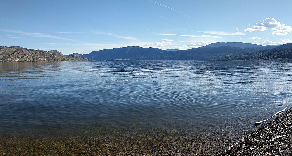
Okanagan Lake — Peachland Waterfront
Peachland, British Columbia
Peachland offers a welcoming lakefront stop on the west shore of Okanagan Lake. The community sits along a popular Okanagan road corridor and gives riders a chance to pause for a meal or waterfront walk before continuing toward Penticton or Kelowna. Rider’s note: Summer waterfront parking is busy; consult local visitor information for access.
Photo: Wikimedia Commons · Photo author & licence
U.S. Mountain Roads & Coastal Legends
20 destinations

Cherohala Skyway
Tellico Plains, Tennessee to Robbinsville, North Carolina
High ridges, deep forest and sweeping mountain curves make the Cherohala Skyway an outstanding touring road in the Southern Appalachians. The byway crosses the Cherokee and Nantahala National Forests, climbing far above the valleys below. Take time at the overlooks and enjoy the long stretches away from towns, where the roadway itself becomes the destination. Rider’s note: Mountain fog, cold temperatures and seasonal road restrictions can appear unexpectedly. Check conditions and fuel before climbing.
Photo: Wikimedia Commons · Photo author & licence

Million Dollar Highway
Ouray to Silverton, Colorado
US 550 between Ouray and Silverton climbs through San Juan Mountain country with steep grades, impressive rock walls and unforgettable views. Small historic mining towns anchor each end of this celebrated Colorado route. The ride has genuinely exposed mountain stretches, so it deserves calm, attentive riding rather than treating the road as a contest. Rider’s note: Watch for weather, construction and steep roadside drop-offs; check Colorado road conditions first.
Photo: Wikimedia Commons · Photo author & licence
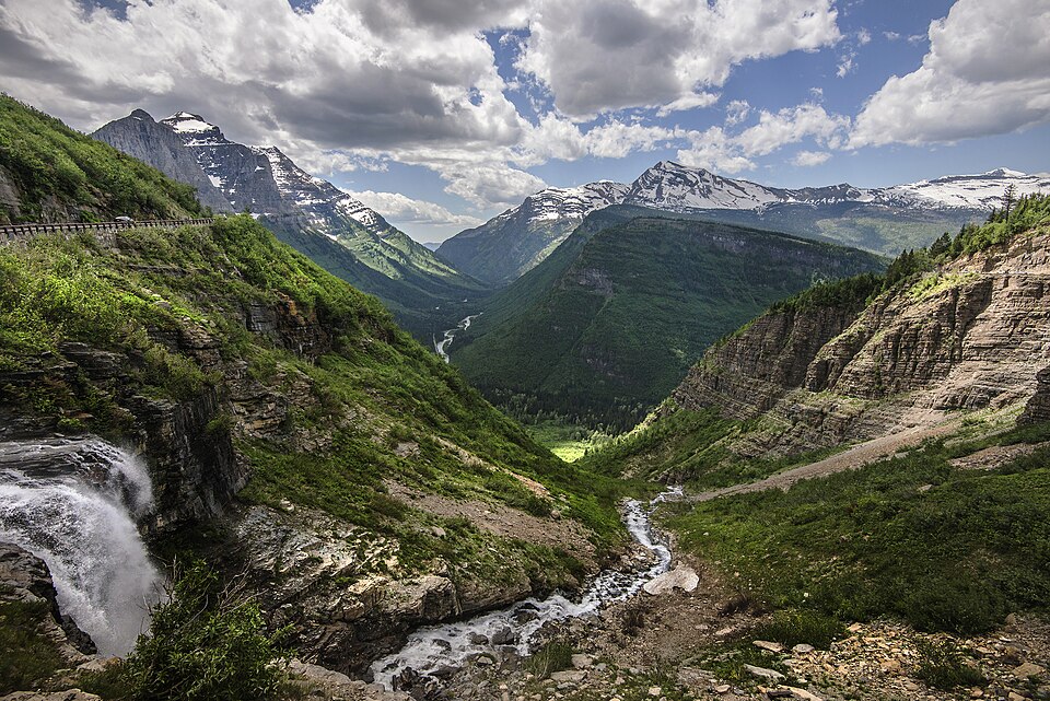
Going-to-the-Sun Road
Glacier National Park, Montana
A landmark mountain road in Glacier National Park, Going-to-the-Sun Road climbs among peaks, waterfalls and alpine scenery. Logan Pass and the views toward Saint Mary Lake turn the crossing into an all-day journey if you enjoy stopping for photographs and exploring viewpoints. Its construction history is nearly as remarkable as its scenery. Rider’s note: The alpine section is seasonal; check NPS opening notices, vehicle restrictions and any reservation requirements.
Photo: Wikimedia Commons · Photo author & licence

Big Sur Highway 1
Big Sur, California
The Pacific Coast Highway through Big Sur is a classic coastal motorcycle drive with cliffside turns, dramatic ocean views and redwood-covered hills rising inland. Pullouts and nearby parks make it easy to turn a ride into a series of memorable stops rather than a single continuous push along the ocean. Rider’s note: Highway 1 can close after landslides; verify Caltrans road conditions immediately before travelling.
Photo: Wikimedia Commons · Photo author & licence

Bixby Creek Bridge
Big Sur, California
The great concrete arch of Bixby Creek Bridge is one of California’s most recognizable coastal landmarks. Crossing it by motorcycle is memorable, but the real reward is taking in the surrounding cliffs and Pacific coastline from a safe designated viewpoint. It fits naturally into a longer Big Sur ride. Rider’s note: Pull over only where legal and safe. Crowding and highway closures are common during peak periods.
Photo: Wikimedia Commons · Photo author & licence
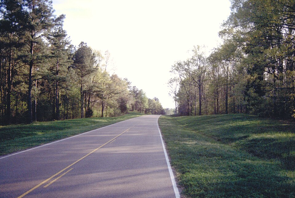
Natchez Trace Parkway
Mississippi, Alabama and Tennessee
The Natchez Trace Parkway is a long, scenic historic route through forests, fields and landscapes tied to an ancient travel corridor. Its gentle curves, relaxed pace and park stops provide a very different experience from high-speed interstate riding. Build in time for overlooks, exhibits and historical sites along the way. Rider’s note: National Park Service rules, speed limits and temporary closures apply; fuel and services are off the parkway.
Photo: Wikimedia Commons · Photo author & licence

Needles Highway
Custer State Park, South Dakota
Needles Highway winds among granite pinnacles in the Black Hills, passing tight rock tunnels and distinctive narrow turns. Its rock formations and scenic stops make it especially appealing to riders combining a Sturgis-area trip with nearby Custer State Park scenery. Rider’s note: Check tunnel dimensions, seasonal opening status and park entrance requirements. Yield cautiously to other traffic.
Photo: Wikimedia Commons · Photo author & licence

Skyline Drive
Shenandoah National Park, Virginia
Skyline Drive follows the Blue Ridge crest through Shenandoah National Park, with repeated overlooks across mountains and valleys. It is a road for unhurried touring, wildlife spotting and enjoying changing colours through the seasons. Connect it with the Blue Ridge Parkway for a much longer mountain journey. Rider’s note: Observe park speed limits, expect wildlife and fog, and review NPS closure notices.
Photo: Wikimedia Commons · Photo author & licence

Badlands Loop Road
Badlands National Park, South Dakota
Badlands Loop Road gives a dramatic change from the pine-covered Black Hills. Broad prairie transitions into layered rock formations, eroded cliffs and overlooks that feel unlike most other American motorcycle routes. It makes an excellent addition to a South Dakota rally trip, especially when you allow time at roadside viewpoints. Rider’s note: Heat, wind and thunderstorms can build quickly. Stay alert for wildlife and stop only in designated areas.
Photo: Wikimedia Commons · Photo author & licence

Utah Scenic Byway 12
Red Canyon to Torrey, Utah
Scenic Byway 12 travels through red-rock country, high plateaus and a landscape of colourful sandstone. The route passes near Bryce Canyon and Grand Staircase–Escalante, offering one of the most varied scenic riding days in the American Southwest. Its appeal is equal parts sweeping roadway and jaw-dropping views. Rider’s note: Carry water and plan fuel. Elevation changes, heat and winter closures can all affect the route.
Photo: Wikimedia Commons · Photo author & licence
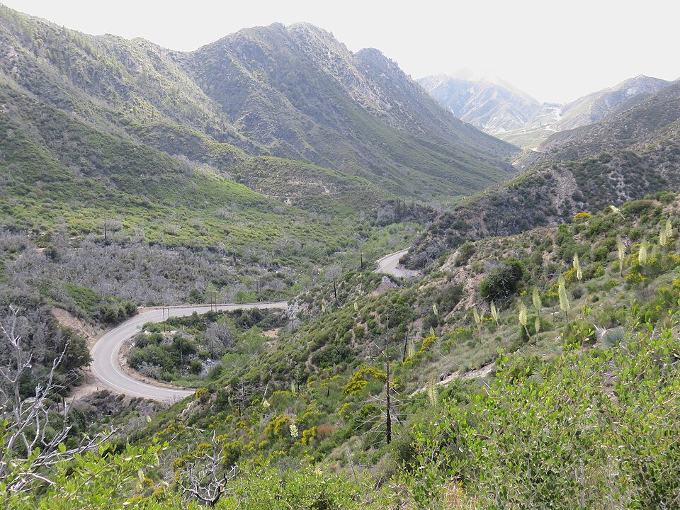
Angeles Crest Highway
La Cañada Flintridge to Wrightwood area, California
Angeles Crest Highway climbs out of the Los Angeles basin into the San Gabriel Mountains, leaving city traffic for pine forest, mountain curves and roadside overlooks. It is a celebrated Southern California motorcycle route with changing terrain and a much cooler climate at higher elevations. Rider’s note: Check Caltrans for storm damage, wildfire closures and rockfall restrictions before setting out.
Photo: Wikimedia Commons · Photo author & licence
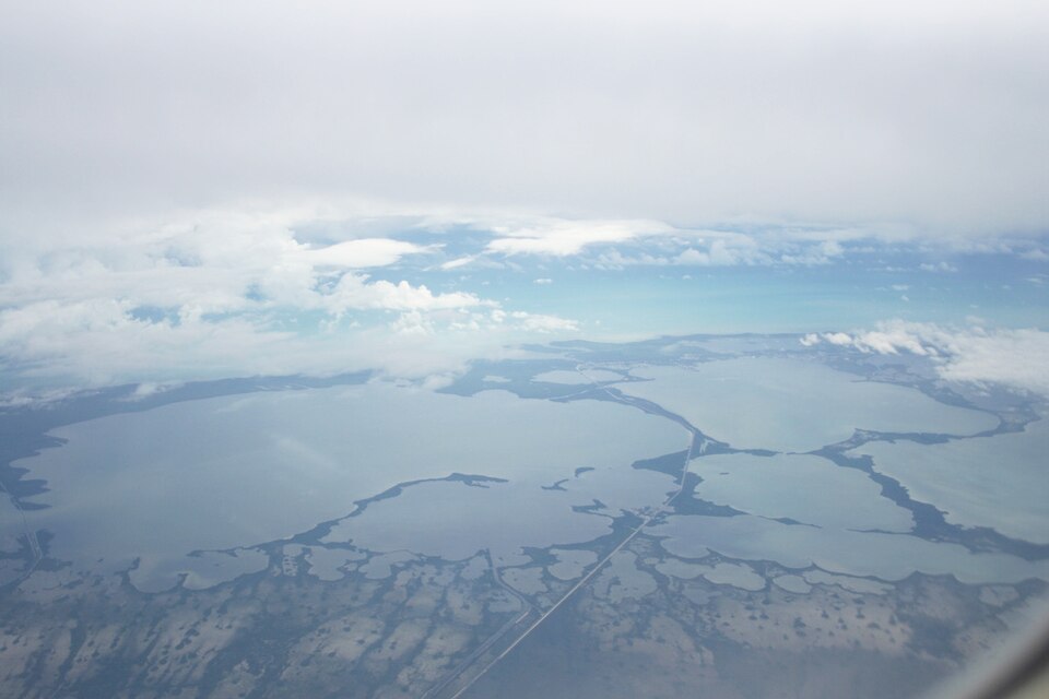
Florida Overseas Highway
Florida City to Key West, Florida
The Overseas Highway connects the Florida Keys across a sequence of islands and bridges, with turquoise water often visible on both sides. This is a relaxed coastal touring route where beach-town stops, seafood, marinas and open-water views are the highlights. Allow plenty of time rather than racing toward the southern end. Rider’s note: Expect heat, sun, wind and heavy holiday traffic; tropical storm disruptions are possible seasonally.
Photo: Wikimedia Commons · Photo author & licence

Bahia Honda Historic Bridge
Bahia Honda State Park, Florida
Bahia Honda’s historic railroad bridge is a striking reminder of the engineering that first connected the Keys. The adjacent state park offers beaches and coastal views, making it a worthwhile break during an Overseas Highway ride. The old bridge is a landmark, not an active motorcycle crossing. Rider’s note: Check park admission, access areas and weather advisories; do not attempt to ride onto the historic bridge.
Photo: Wikimedia Commons · Photo author & licence
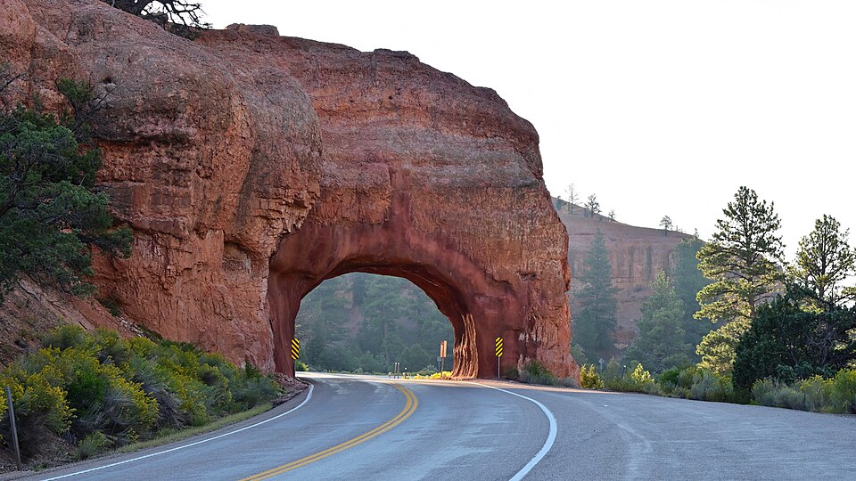
Red Canyon Tunnels
Near Bryce Canyon, Utah
The red-rock tunnels along Utah Scenic Byway 12 are a signature photo stop where the roadway passes straight through vivid sandstone formations. Riders heading toward Bryce Canyon often encounter this section early in the journey, and it makes an easy reminder that Utah’s landscape is as memorable as any destination. Rider’s note: Use proper pullouts for photographs; traffic and roadside hazards demand attention.
Photo: Wikimedia Commons · Photo author & licence
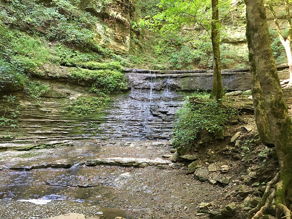
Jackson Falls — Natchez Trace
Near Hohenwald, Tennessee
Jackson Falls is a pretty stop on the Natchez Trace Parkway, with a short walk leading down to the waterfall area. It gives motorcycle travellers a welcome break from the saddle while exploring the parkway’s history and natural surroundings. Take time to enjoy the trail rather than expecting a drive-up viewpoint. Rider’s note: The trail has grades and steps; wear sensible shoes and check NPS notices for wet or closed paths.
Photo: Wikimedia Commons · Photo author & licence

Cherohala Skyway Autumn Overlook
Tennessee side of Cherohala Skyway
Autumn colours are a special reason to ride the Tennessee side of the Cherohala Skyway, when hillsides of hardwood trees contrast with mountain evergreens. Pull into a designated overlook to appreciate the layered valleys and plan a quiet break away from busier tourist routes. Rider’s note: Fall weather can shift rapidly. Be prepared for chilly ridgelines, leaf debris and fog.
Photo: Wikimedia Commons · Photo author & licence

Saint Mary Valley Roadside Views
Glacier National Park, Montana
The eastern portion of Going-to-the-Sun Road opens impressive views toward Saint Mary Lake and surrounding mountains. Riders can appreciate broad scenery and changing terrain before the road gains height toward Logan Pass. The area rewards patience and frequent photography stops rather than rushing through. Rider’s note: Glacier’s alpine roads are seasonal; stay in marked pullouts and follow park restrictions.
Photo: Wikimedia Commons · Photo author & licence

Escalante River Valley
Grand Staircase–Escalante region, Utah
The Escalante River Valley is one of the most striking landscapes along Utah Highway 12. Wide canyon country, changing stone colours and nearby recreation areas make it a powerful place to stop and take in the Southwest. It fits naturally into a Bryce Canyon-to-Torrey touring day. Rider’s note: Expect heat, exposed roads and limited services. Respect protected public lands and stay on permitted routes.
Photo: Wikimedia Commons · Photo author & licence
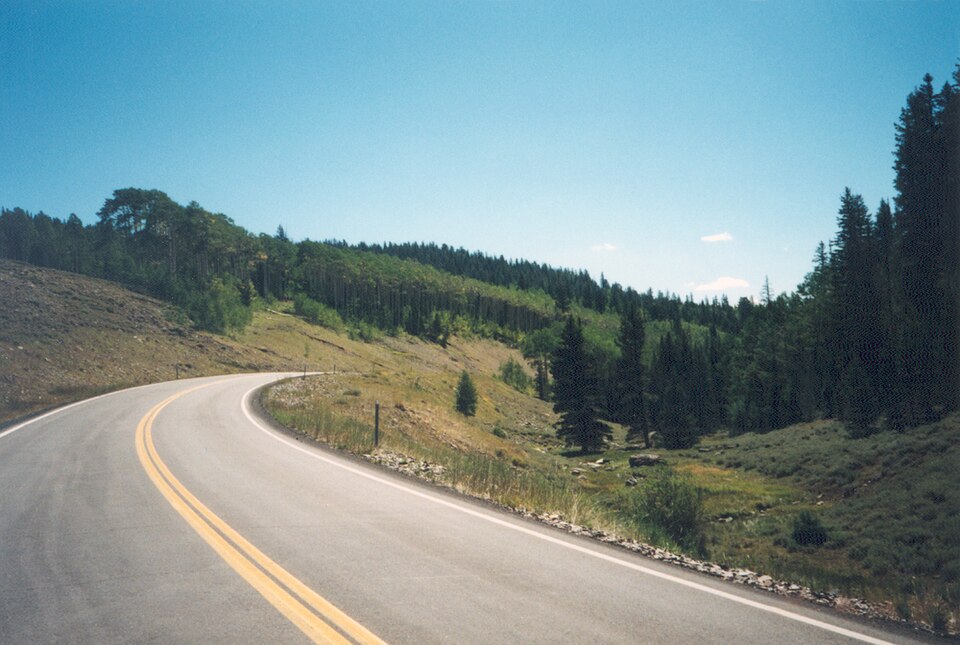
Panguitch Country — Scenic Byway 12
Near Panguitch and Red Canyon, Utah
The western approach to Scenic Byway 12 near Panguitch runs through red-rock landscapes and mountain roads that set the stage for the Utah canyon country ahead. It is an excellent starting area for riders headed toward Bryce Canyon or the longer high-plateau byway. Rider’s note: Weather and elevation changes matter; start with adequate fuel and watch for other sightseers.
Photo: Wikimedia Commons · Photo author & licence
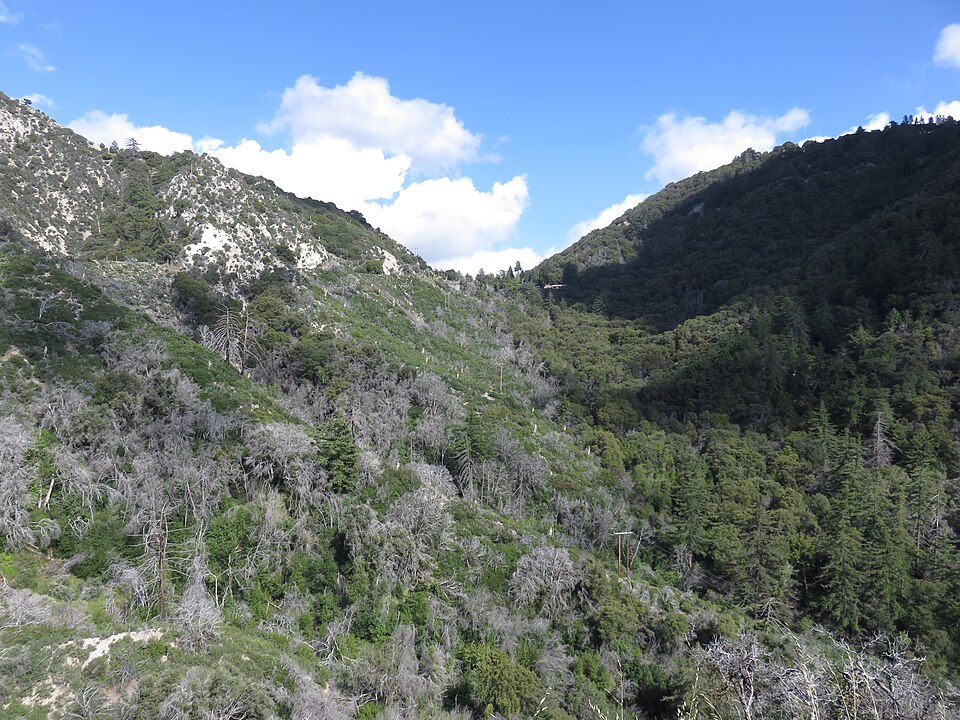
Red Box Saddle — Angeles Crest
San Gabriel Mountains, California
Red Box Saddle sits amid the higher-country scenery accessed by Angeles Crest Highway, near forest and mountain recreation areas. It offers a useful rest point during a San Gabriel Mountains ride and a chance to appreciate terrain that feels far removed from the city below. Rider’s note: Mountain access and trailheads may be affected by fire, weather or construction; check current Forest Service alerts.
Photo: Wikimedia Commons · Photo author & licence
More American Roads, Parks & Riding Destinations
20 destinations
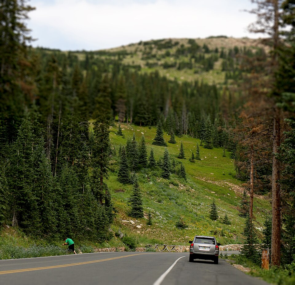
Trail Ridge Road — Rocky Mountain National Park
Estes Park to Grand Lake, Colorado
Trail Ridge Road climbs above treeline through Rocky Mountain National Park, delivering wide alpine views and a remarkable sense of elevation. This is one of America’s highest continuous paved touring roads, with overlooks where riders can appreciate the scale of the Rockies. The mountain landscape is the main attraction, so a relaxed pace makes the journey worthwhile. Rider’s note: The road is seasonal. Expect severe weather, cold temperatures and possible timed-entry rules.
Photo: Wikimedia Commons · Photo author & licence
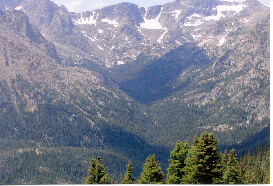
Forest Canyon Overlook
Trail Ridge Road, Colorado
Forest Canyon Overlook offers a dramatic pause along Trail Ridge Road, with a view over steep mountain valleys and distant peaks. It is an excellent place to break up the climb and get off the motorcycle for a short walk to a viewing area while exploring the high-elevation park. Rider’s note: Use designated parking and prepare for cold wind, thin air and rapidly changing weather.
Photo: Wikimedia Commons · Photo author & licence

Kancamagus Highway — White Mountains
Lincoln to Conway, New Hampshire
The Kancamagus Highway crosses White Mountain National Forest on Route 112, linking river valleys, forested passes and established scenic overlooks. Its reputation as a classic autumn foliage ride is well earned, but the route is equally enjoyable for its mountain-road character in warmer months. Rider’s note: Traffic increases sharply during autumn colour season. Watch for wildlife, slippery leaves and variable weather.
Photo: Wikimedia Commons · Photo author & licence

Mount Washington Auto Road
Gorham area, New Hampshire
The Mount Washington Auto Road climbs toward the summit of New England’s highest peak, giving travellers mountain views and a memorable high-elevation experience. The steep grades and switchbacks make it very different from ordinary touring roads. Motorcycle access is subject to the road operator’s rules and conditions. Rider’s note: Verify motorcycle eligibility, seasonal openings, fees and weather directly with the operator before attempting the climb.
Photo: Wikimedia Commons · Photo author & licence

Mount Washington Summit View
Mount Washington, New Hampshire
At the top of the Mount Washington Auto Road, riders who are admitted under the current operating rules are rewarded with expansive summit scenery and historic mountain attractions. On a clear day the views stretch across the White Mountains; in bad weather, the summit can feel like another climate entirely. Rider’s note: Summit weather is notoriously unpredictable. Check the mountain observatory forecast and road status.
Photo: Wikimedia Commons · Photo author & licence
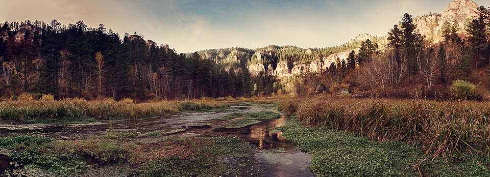
Spearfish Canyon Scenic Byway
Spearfish to Savoy area, South Dakota
Spearfish Canyon is a Black Hills riding favourite, with steep limestone walls, forest and a curving road alongside the creek. It offers a cooler, wooded contrast to the wide prairie and Badlands, making it a natural addition to a Sturgis motorcycle itinerary. Rider’s note: Be cautious in shaded curves and around wildlife. Enjoy waterfalls from safe turnouts.
Photo: Wikimedia Commons · Photo author & licence

Roughlock Falls — Spearfish Canyon
Savoy area, South Dakota
Roughlock Falls is a waterfall destination tucked away from the main Spearfish Canyon road. A stop here gives riders a chance to enjoy forest scenery, streamside pathways and photographs without having to plan a full mountain hike. The setting makes a peaceful contrast to downtown rally crowds. Rider’s note: Follow posted trail and parking rules; parts of the access may be seasonal or slippery.
Photo: Wikimedia Commons · Photo author & licence

Devils Tower National Monument
Near Hulett, Wyoming
Devils Tower rises abruptly above Wyoming’s surrounding rolling country, making it one of the most recognizable sights on a northern Plains ride. Its cultural significance, geology and nearby walking trails make it worth more than a quick photograph. Many Black Hills riders add it as a longer scenic side trip. Rider’s note: Respect the monument’s cultural importance and check park entrance, access and trail information.
Photo: Wikimedia Commons · Photo author & licence
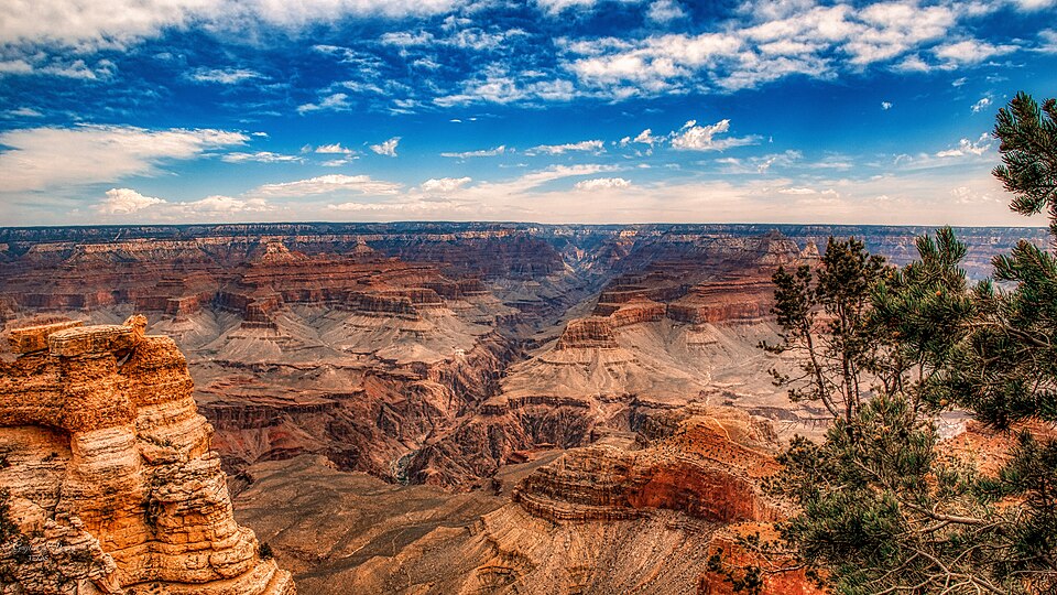
Grand Canyon — Mather Point
South Rim, Arizona
Mather Point is a celebrated overlook on the South Rim of the Grand Canyon, opening into immense layered rock formations and distant canyon views. It makes a powerful off-bike stop during an Arizona touring trip, with visitor facilities and nearby trails providing opportunities to learn more about the park. Rider’s note: Allow for heavy crowds, park entrance procedures and intense summer heat.
Photo: Wikimedia Commons · Photo author & licence

Grand Canyon — Desert View
Eastern South Rim, Arizona
Desert View brings a different perspective to the Grand Canyon’s eastern reaches, where open views take in the Colorado River landscape and canyon walls. It works especially well for riders approaching or leaving the park from the east and allows a scenic stop beyond the busiest central overlooks. Rider’s note: Check park access, road restrictions and weather; stop at designated overlooks.
Photo: Wikimedia Commons · Photo author & licence

Bryce Canyon — Sunrise Point
Bryce Canyon National Park, Utah
Bryce Canyon’s amphitheatre is famous for dense groups of orange and red hoodoos rising from the landscape. Sunrise Point is a rewarding stop for riders connecting Scenic Byway 12 with the park, and the views make a striking contrast to Utah’s high plateaus. Rider’s note: Park your bike and follow established walking paths; winter snow and ice can affect access.
Photo: Wikimedia Commons · Photo author & licence

Multnomah Falls — Columbia River Gorge
Near Bridal Veil, Oregon
Multnomah Falls cascades through the Columbia River Gorge beside the Historic Columbia River Highway corridor. The waterfall, footbridge and lush forest setting make a memorable pause on an Oregon motorcycle trip, whether you are exploring the Gorge or travelling between Portland and the mountains. Rider’s note: Parking and timed-use restrictions may apply seasonally; check the official access rules before arrival.
Photo: Wikimedia Commons · Photo author & licence

Pikes Peak Highway
Near Colorado Springs, Colorado
Pikes Peak Highway climbs dramatically toward the summit of Pikes Peak, offering a high-altitude roadway with tight turns and views across the Front Range. For experienced riders, the scenery and mountain atmosphere are unforgettable, especially when you allow time for safe stops. Rider’s note: Check the operator’s motorcycle requirements, brake-check procedures, weather and advance reservations.
Photo: Wikimedia Commons · Photo author & licence

Pikes Peak — Mountain Descent
Pikes Peak, Colorado
Descending the high slopes of Pikes Peak reveals how dramatically the landscape changes with altitude. This is a good moment to appreciate the scale of the mountain and reflect on the ride, rather than looking at the summit as the only destination. Rider’s note: Use engine braking appropriately, follow posted requirements and never overheat your brakes.
Photo: Wikimedia Commons · Photo author & licence

Mount Rushmore — Black Hills Stop
Keystone, South Dakota
Mount Rushmore is one of the best-known landmarks in the Black Hills and a natural stop on a South Dakota motorcycle tour. Riders can combine the monument with nearby winding roads, small towns and viewpoints to create a day that goes beyond the annual Sturgis Rally. Rider’s note: Follow memorial parking and entry rules and expect substantial crowds during peak periods.
Photo: Wikimedia Commons · Photo author & licence

Crater Rim Drive — Hawaiʻi Volcanoes
Hawaiʻi Volcanoes National Park, Hawaiʻi
Crater Rim Drive explores the volcanic landscape around Kīlauea, where lava fields, forest and sweeping crater views create an unusual motorcycle excursion. It is a completely different environment from continental mountain touring, and park information helps visitors understand the active geology. Rider’s note: Volcanic activity, gas advisories and road closures change; consult current National Park Service updates.
Photo: Wikimedia Commons · Photo author & licence

Iron Mountain Road — Black Hills
Near Keystone, South Dakota
Iron Mountain Road is famous for its corkscrew-style turns, rock tunnels and deliberately framed views toward Mount Rushmore. It is a ride that rewards smooth, patient control and frequent stops for scenery rather than speed. The distinctive engineering makes the road a special part of a Black Hills trip. Rider’s note: Expect narrow tunnels, tight switchbacks and other vehicles stopping to admire the view.
Photo: Wikimedia Commons · Photo author & licence

Bridal Veil Falls — Spearfish Canyon
Spearfish Canyon, South Dakota
Bridal Veil Falls is a pleasant waterfall stop beside Spearfish Canyon Scenic Byway. The waterfall flows down a steep rock face, and the surrounding forested canyon contributes to the atmosphere of a relaxed Black Hills day ride. Rider’s note: Flow varies by season; use proper roadside parking and avoid stopping in traffic lanes.
Photo: Wikimedia Commons · Photo author & licence
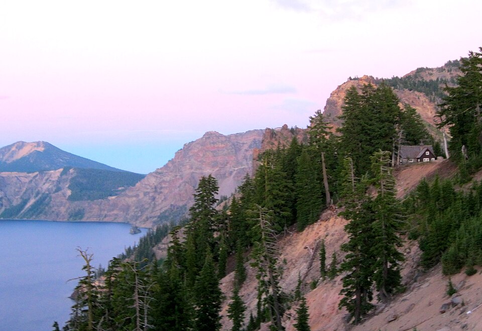
Crater Lake — Rim Village Views
Crater Lake National Park, Oregon
Crater Lake is a deep-blue volcanic lake surrounded by steep caldera walls. The Rim Village area provides one of the most memorable viewpoints on a southern Oregon motorcycle tour, with further scenery along the park’s seasonal rim roads. Rider’s note: Snow closes portions of Rim Drive for much of the year; check NPS road status and parking.
Photo: Wikimedia Commons · Photo author & licence
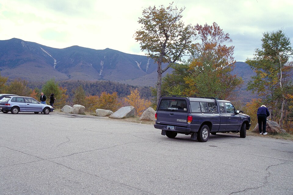
Pemigewasset Overlook — Kancamagus
Kancamagus Highway, New Hampshire
Pemigewasset Overlook offers a broad view of White Mountain forest along the Kancamagus Highway. It is ideal for a deliberate photo break on a Route 112 ride and especially colourful during the autumn foliage season. Rider’s note: Use designated parking and respect crowded turnout areas during fall leaf-viewing weekends.
Photo: Wikimedia Commons · Photo author & licence
Europe — Legendary Passes & Coastal Roads
20 destinations
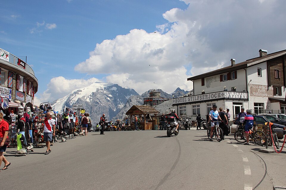
Stelvio Pass — Alpine Hairpins
Bormio–Prato allo Stelvio, Italy
Stelvio Pass is among Europe’s most legendary motorcycle roads, rising through the Italian Alps in a series of steep switchbacks. The climb is especially impressive from the eastern side, where the road zigzags up the mountain toward high-altitude views and summit services. For many touring riders, reaching Stelvio is a genuine bucket-list moment. Rider’s note: The pass is seasonal; check weather, traffic restrictions and opening dates. Ride patiently through the tight bends.
Photo: Wikimedia Commons · Photo author & licence
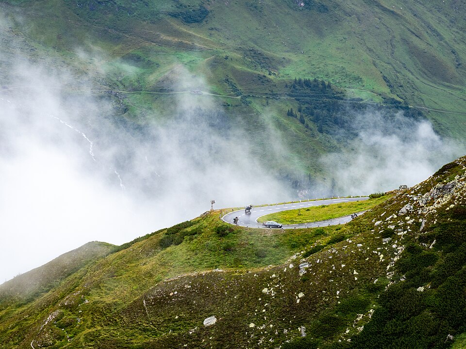
Grossglockner High Alpine Road
Fusch to Heiligenblut, Austria
The Grossglockner High Alpine Road crosses Austria’s High Tauern mountain scenery, combining dramatic curves, sweeping alpine landscapes and viewpoints. It is a toll-road touring experience where the journey is designed around the mountains themselves, with rest stops that invite riders to enjoy the peaks and learn about the surrounding national park. Rider’s note: Seasonal closures and tolls apply. Check the road operator’s daily opening and weather reports before departure.
Photo: Wikimedia Commons · Photo author & licence
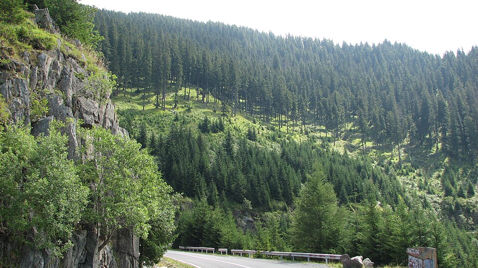
Transfăgărășan — Carpathian Mountain Road
Făgăraș Mountains, Romania
Romania’s Transfăgărășan is celebrated for its dramatic climbing road and succession of sharp bends in the Southern Carpathians. Mountain scenery, tunnels and high-altitude viewpoints make the crossing a memorable ride when the central section is open. Its engineering and landscape create a sense of adventure even at modest speeds. Rider’s note: The high section closes seasonally and can be affected by snow, landslides and rockfall; check current Romanian road notices.
Photo: Wikimedia Commons · Photo author & licence

Trollstigen — Norway's Troll Road
Rauma, Møre og Romsdal, Norway
Trollstigen climbs a dramatic Norwegian mountainside with a famous series of hairpin bends, waterfalls and valley views. It is one of Scandinavia’s most striking motorcycle destinations, and the viewing platforms let travellers appreciate the road from above. The setting is especially memorable when low cloud moves between the surrounding peaks. Rider’s note: Rockfall-related closures have affected this road; check Norwegian authorities for the latest access restrictions before planning a ride.
Photo: Wikimedia Commons · Photo author & licence
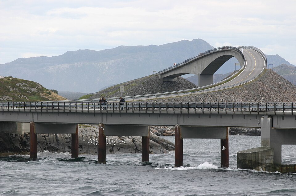
Atlantic Ocean Road — Island Bridges
Averøy and Hustadvika, Norway
The Atlantic Ocean Road threads across small Norwegian islands connected by a series of bridges, placing riders close to the sea and open sky. Its short length makes it easy to explore slowly, with viewpoints that reveal the striking engineering and coastal environment. On windy days, the same setting can feel much wilder than the photograph suggests. Rider’s note: Watch for strong crosswinds, sea spray and storms; stop only at designated pullouts.
Photo: Wikimedia Commons · Photo author & licence
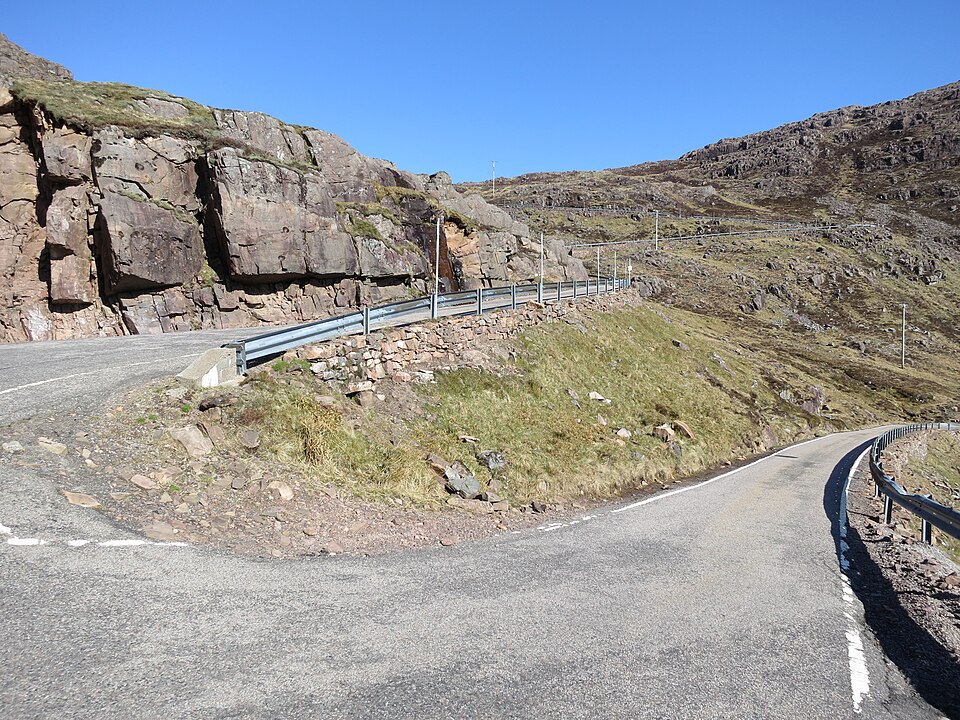
Bealach na Bà — Pass of the Cattle
Applecross Peninsula, Scottish Highlands
Bealach na Bà is a demanding single-track mountain road that climbs toward the Applecross Peninsula through steep grades and exceptionally tight bends. Its switchbacks and expansive views explain why it has become famous among motorcycle tourists. The journey rewards careful throttle control and an appreciation of Highland scenery rather than speed. Rider’s note: Not suitable for nervous or inexperienced mountain riders. Give way correctly at passing places and check severe-weather warnings.
Photo: Wikimedia Commons · Photo author & licence

Col du Galibier — French Alpine Pass
Valloire to Col du Lautaret, France
The Col du Galibier is an iconic French Alpine crossing, well known in cycling history but equally memorable from a motorcycle. Approaching the summit reveals high mountain scenery, steep slopes and open views across the surrounding peaks. It makes a natural part of a longer journey through the French Alps rather than an isolated destination. Rider’s note: Alpine passes can close for winter or weather; watch for cyclists, falling temperatures and narrow sections.
Photo: Wikimedia Commons · Photo author & licence
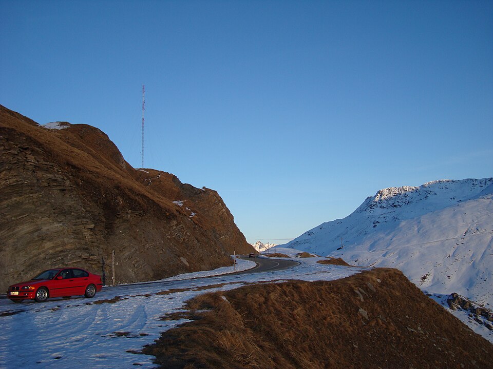
Furka Pass — Swiss Alpine Switchbacks
Uri–Valais, Switzerland
The Furka Pass connects dramatic Swiss Alpine valleys with serpentine mountain roads and viewpoints over rugged peaks. Its combination of hairpins, altitude and historic roadside buildings attracts riders planning a classic Swiss mountain-pass tour. Nearby passes can be linked into a longer day of spectacular riding if conditions allow. Rider’s note: Confirm pass-opening status and road restrictions before travel, and be prepared for cold and sudden mountain weather.
Photo: Wikimedia Commons · Photo author & licence

Grimsel Pass — Lakes and Granite
Bern–Valais, Switzerland
Grimsel Pass is famous for its mountain reservoirs, bare granite slopes and sweeping bends between the Bernese Oberland and Valais. Its scenery feels rugged and almost lunar in places, providing a striking contrast to lush lower valleys. Many touring riders combine Grimsel with the Furka or Susten passes to experience several mountain landscapes in one journey. Rider’s note: Check seasonal openings and avoid planning tight connections across multiple high passes without weather flexibility.
Photo: Wikimedia Commons · Photo author & licence
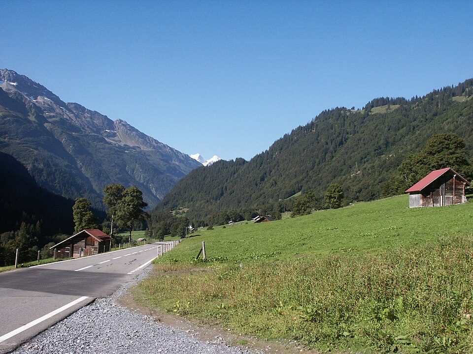
Susten Pass — Swiss Mountain Touring
Innertkirchen to Wassen, Switzerland
Susten Pass delivers an outstanding mixture of sweeping turns, rocky cliffs, alpine meadows and mountain tunnel sections. The scenery changes repeatedly as the road crosses from one Swiss valley to another. It is especially attractive for riders who enjoy smooth, measured touring and frequent scenic stops rather than city traffic. Rider’s note: Weather and seasonal restrictions determine access. Watch for cyclists, tunnels and wet mountain surfaces.
Photo: Wikimedia Commons · Photo author & licence
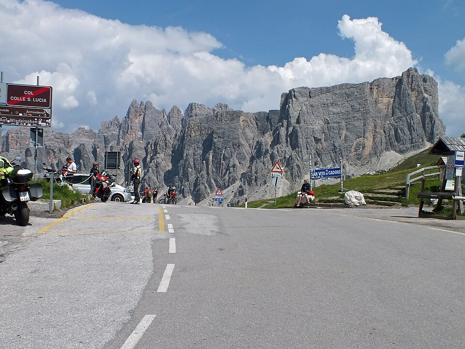
Passo Giau — Dolomite Peaks
Cortina d'Ampezzo area, Italy
Passo Giau is one of the Dolomites’ memorable mountain roads, winding between dramatic limestone peaks and open alpine pastures. The views change at nearly every turn, with roadside opportunities to stop and admire the mountains. The pass makes a strong addition to a longer Dolomites tour through Cortina and surrounding valleys. Rider’s note: The route is exposed to fast weather changes and seasonal snow; expect other tourists and cyclists at the summit.
Photo: Wikimedia Commons · Photo author & licence

Ring of Kerry — Atlantic Touring Loop
County Kerry, Ireland
The Ring of Kerry is a scenic loop around the Iveragh Peninsula, where mountain views, lakes, villages and Atlantic coastline come together. For motorcycle travellers, the appeal is the combination of narrow rural roads and memorable stopping places rather than technical speed. Allow time for coastal photographs and short walks in the towns along the route. Rider’s note: Expect tour buses, changing weather and narrow road sections. Leave space for larger vehicles and plan rest stops.
Photo: Wikimedia Commons · Photo author & licence
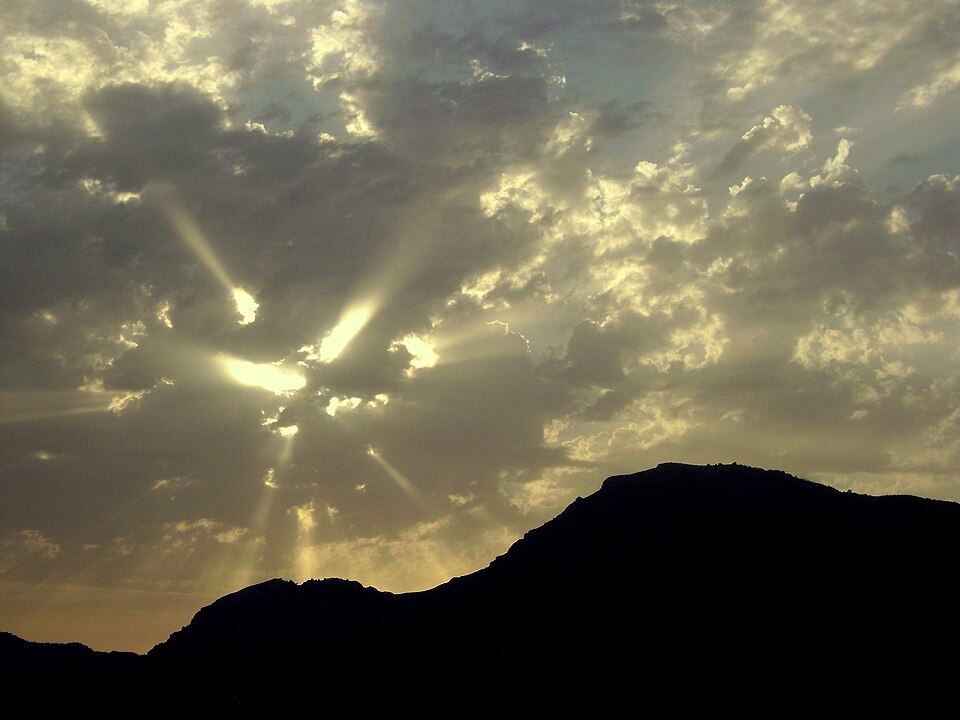
Amalfi Coast Road — Coastal Cliffs
Sorrento Peninsula to Amalfi coast, Italy
The Amalfi Coast is a dramatic stretch of Italian shoreline where steep hills rise above tightly packed villages and the road follows cliffside contours. The views are remarkable, but the drive is often slow, crowded and narrow. This is a touring destination for riders who want sea scenery, historic towns and time away from the bike. Rider’s note: Access restrictions can apply to motorcycles and other vehicles during busy periods; check local regulations before riding.
Photo: Wikimedia Commons · Photo author & licence

Llanberis Pass — Eryri Mountains
Llanberis to Pen-y-Pass, Wales
Llanberis Pass runs through dramatic mountain country in Eryri (Snowdonia), with dark rock walls, open valleys and views toward Yr Wyddfa. It is a well-known scenic road in North Wales and a natural part of a wider Welsh mountain ride. Riders can combine the pass with village stops and other mountain roads in the region. Rider’s note: Expect walkers, cyclists, narrow roads and fast-changing weather. Parking near trailheads is limited and regulated.
Photo: Wikimedia Commons · Photo author & licence
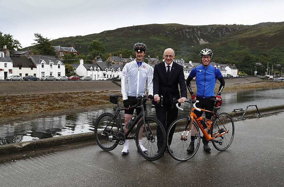
North Coast 500 — Highlands Circuit
Inverness and Northern Highlands, Scotland
The North Coast 500 links dramatic Scottish Highland scenery, remote villages, rugged beaches and mountain passes into a long touring circuit. It has become a bucket-list trip for motorcycle travellers who want variety and a strong sense of place. The best experience comes from allowing several days and enjoying local communities rather than attempting the entire loop quickly. Rider’s note: Many roads are narrow and some are single track. Use passing places properly and respect residents and livestock.
Photo: Wikimedia Commons · Photo author & licence

Grossglockner — Glacier Viewpoints
High Tauern, Austria
The glacier viewpoints along the Grossglockner High Alpine Road add a different experience to the riding itself. Visitors can pause to view ice, rock and the high Austrian mountains, learning about the changing alpine environment. They make a rewarding scenic stop during an already remarkable motorcycle journey. Rider’s note: Glacier areas are sensitive and alpine weather can turn quickly. Check the road opening and designated visitor access.
Photo: Wikimedia Commons · Photo author & licence
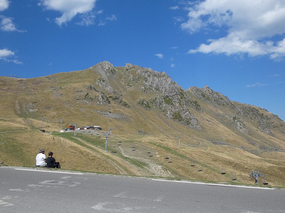
Col du Tourmalet — Pyrenees
Hautes-Pyrénées, France
Col du Tourmalet is a celebrated French Pyrenean pass known to cycling fans around the world and equally appealing as a mountain road for touring riders. The road climbs through valleys to open summit scenery, with dramatic views over surrounding ridges. It can be paired with other Pyrenean passes for an extended multi-day ride. Rider’s note: Expect cyclists, steep gradients and rapidly shifting mountain weather; check seasonal access.
Photo: Wikimedia Commons · Photo author & licence

Col de l'Iseran — High French Alps
Val d'Isère to Bonneval-sur-Arc, France
Col de l'Iseran is a very high paved Alpine crossing with extensive mountain views and a road that winds through striking rocky terrain. The pass connects the Tarentaise and Maurienne valleys, making it an impressive leg of a French Alps touring route. A stop at the high point is worth planning rather than treating it merely as a transit road. Rider’s note: The pass is often closed outside summer and can close during storms. Check official road status before travelling.
Photo: Wikimedia Commons · Photo author & licence

Stigfossen Viewpoint — Trollstigen
Rauma, Norway
The Stigfossen area gives visitors a vantage point to appreciate the scale of the Trollstigen mountain road, including the steep valley and waterfall scenery. It offers a chance to step off the motorcycle and see the switchbacks from a different perspective, where the road’s engineering becomes part of the landscape. Rider’s note: Access has been affected by rockfall concerns. Check official local notices before approaching the area.
Photo: Wikimedia Commons · Photo author & licence
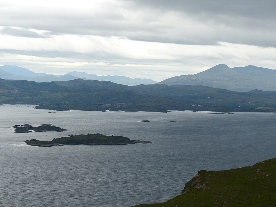
Applecross Peninsula — Highland Coast
Wester Ross, Scotland
The Applecross Peninsula is a memorable Scottish Highlands destination, with remote coastal views, a quiet village atmosphere and spectacular access roads. Many riders arrive via Bealach na Bà, then take time to explore the peninsula rather than immediately turning back. It makes a natural pause on a longer western Highlands or NC500 itinerary. Rider’s note: Single-track access and changeable coastal weather call for patient, courteous riding and realistic travel times.
Photo: Wikimedia Commons · Photo author & licence
KNOW A ROADHOUSE WORTH THE RIDE?
Independent garages and custom shops, rider-friendly motels, campgrounds, roadhouses and scenic motorcycle routes all belong in WTN Roadhouse. Have a genuine place to recommend? Send the name, location, website, what makes it worthwhile, and photographs you own or have permission to share. We review submissions before publishing.
We are growing the independent motorcycle shop listings carefully rather than using unrelated images or unverified business claims. No paid placement is represented as an independent recommendation.
CONTACT WTN TO SUBMIT A LOCATION · SEE UPCOMING RALLIES & BIKER PARTIES · VISIT WTN MERCH
Roadhouse is an independent editorial guide. Locations and services can change; confirm opening hours, routes, road closures, seasonal access and motorcycle policies before travel. Images are historical or illustrative of the named actual locations, not live conditions. Photographers and licence details are linked on each listing. Research updated November 14, 2026.